Unit 1: Thinking Geographically
Maps, Maps, Maps!

|
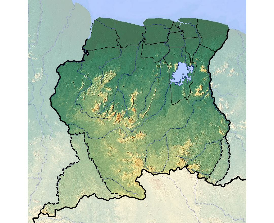
To the left is a physical map for Suriname and above this is a physical map for Malaysia. (Mapsland.com and Google Earth) A physical map shows the physical characteristics of the land, such as mountains, deserts, and bodies of water.
|
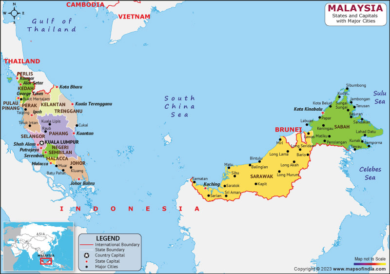
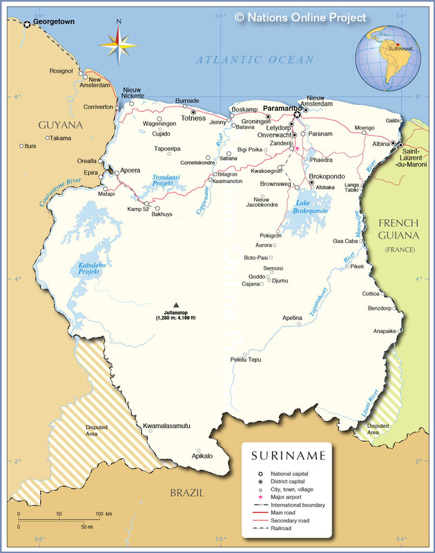
To the right of this is the political map of Suriname, and above is the political map of Malaysia. (Nationsonline.org and Indiamap.com) A political map shows jurisdictional and political boundaries, capitals and even sometimes roads. Basically human created boundaries.
|
|
Choropleth Map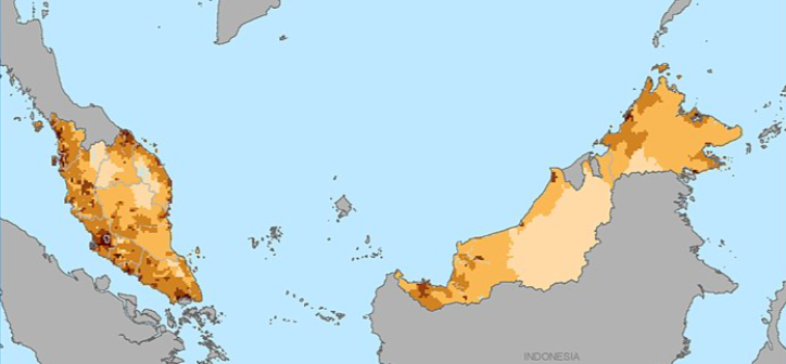
|

The map and key to the left is of Malaysia and represents the population density of the land. (https://sedac.ciesin.columbia.edu/)
A choropleth map is a map that uses differences in color or shading to represent average values (usually quantity of people.) |
Isoline MapThis is a Isoline map for Suriname. It shows the annual rainfall in inches. (UTexas.edu) An Isoline map uses lines to connect similar points locations with similar values. Isoline maps are usually used to represent surface elevations, temperature, and to measure depth of bodies of water.
|

|
|
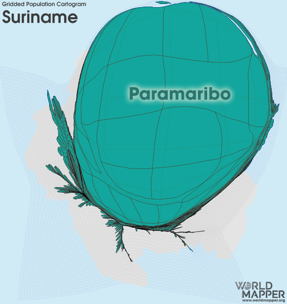
Cartogram A cartogram is a thematic map where geographic size is altered to be proportional to a different variable than land size. Geographic space itself is warped, sometimes extremely, in order to visualize the distribution of said variable.
This is a cartograph of Suriname which represents the population. The total population of Suriname is approximately 613,000 people, 240,00 of those people (just over 1/3) live in the capital, Paramaribo. This map shows that the grand majority of people living in Suriname live in Paramaribo, it does this distorting the land. |
